
John Morris, G4ANB, originally devised the system in England in 1980, which is in widespread use by radio amateurs around the world.
The grid locator system comes into its own particularly on VHF and above where stations are keen to record contact (QSO) distances. Maidenhead locators are also commonly referred to as QTH Locator
Many VHF and above contests, rely on stations knowing their grid locator so that points can be allocated based on the distance between stations.
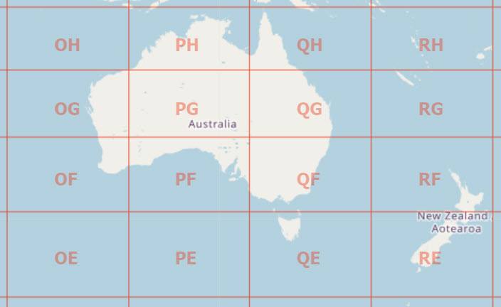
The actual grid locator for a station’s location is derived from their latitude and longitude on the earth and generally consists of 2 letters, 2 numbers and 2 letters.
The whole world has been divided into grid squares. For Australia the first two grid square letters range from OH at the top western extreme of Australia to QE for Tasmania and to the east. In New Zealand only two grids cover the country, RF and RE.
https://www.levinecentral.com/ham/grid_square.php
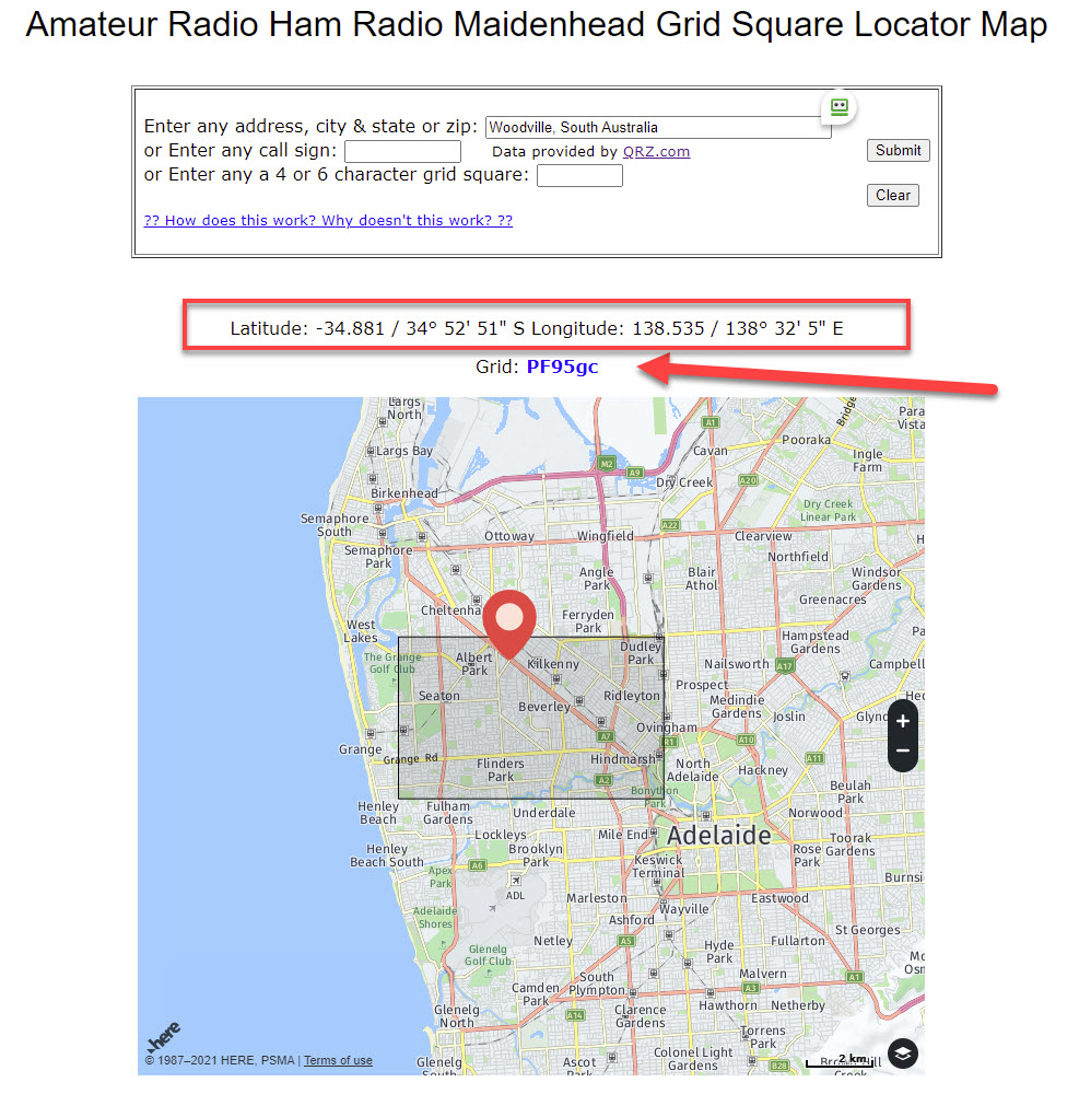
To use the map, I have added my location as Woodville, South Australia.
As you can see the red arrow shows my grid location and the red outlined box shows the latitude and longitude
More information can be found here about the Grid Square Locator System.